

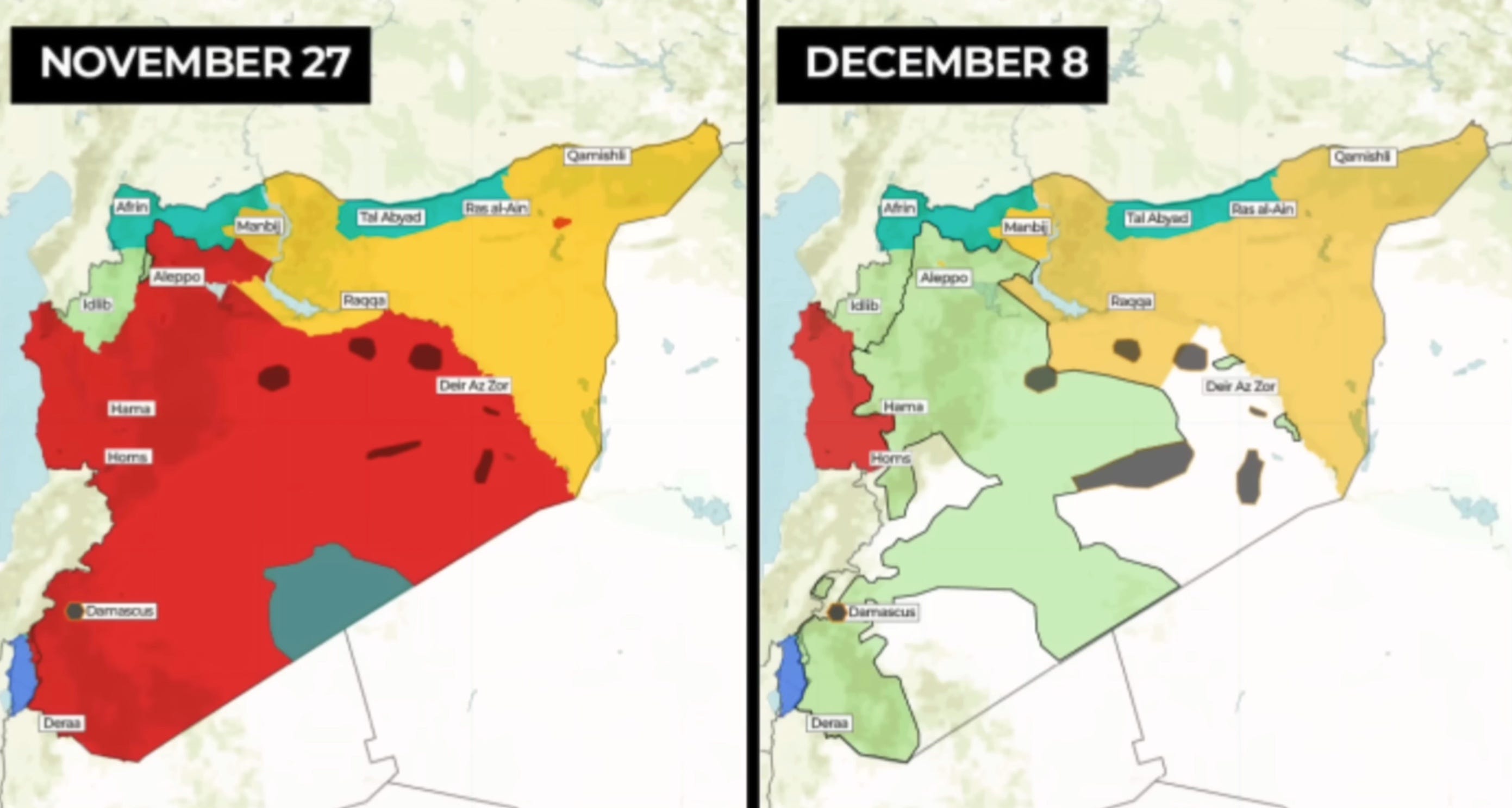
The Syrian regime fell in just one Scaramucci and Assad has fled to Moscow. The colors on the new map denote:
Light Green - Syrian rebels collective, the new government.
Gold - U.S. backed Kurdish area.
Darker Green - Turkish buffer zone.
Red - Russian area containing Latakia and Tartus naval supply station.
Grey - surviving bits of ISIS.
White - low population and nobody really in charge.
Blue - Sea of Galilee, Golan Heights is the tiny thing at its upper right.
There are a few big questions open:
How quickly will the Kurds vs. Turks situation settle?
Will Russia be able to retain the Tartus naval supply station?
Will Russia be able to retain the airfield they use for African operations?
Will Israel retain the Golan Heights buffer zone, near the Sea of Galilee?
To be clear, the Golan Heights is well defined and was annexed by Israel. They have taken over an additional 155 square mile buffer zone bordering the existing area, a nominally temporary move while Syria assembles a new government. They are accused of a land grab, but it’s unclear if they really want the territory, or just want to ensure peace and quiet.
This map by Michael Izady shows the ethnic groups within the Russia controlled area, it’s a snippet of the original with the legend moved next to the complex coastal populations. This map is over twenty years old and I’m not sure if the Kurdish areas remain Kurdish, or if they migrated due to the civil war. The Assad family are Alawites, a minority group that dominated the majority Sunni and Kurd areas for the last fifty years.
